
What is a storymap?
A Storymap is a map-based interactive application created to tell a story. Below are the Storymaps that have been created by the Eastern Shore Archives.
NOTE: Loading time for interactive elements within the storymaps may be affected by slower internet connections.

Churches of the Eastern Shore
An interactive overview of historical and modern churches on the Eastern Shore of Nova Scotia between Lawrencetown and Ecum Secum. For the purposes of this project, a church is defined as a building that holds, or once held, regular gatherings for the purpose of worship. (Winter 2022-23)

A History of the Eastern Shore Islands
An illustrated overview of the long history of human use and occupation in the Eastern Shore Islands, a remarkable coastal archipelago along the Atlantic coast of Nova Scotia between Jeddore and Liscomb.
Research & Content by Sara Spike with support by the Eastern Shore Archives (Lake Charlotte Area Heritage Society). Financial support provided by CLARI. Financial support provided by The Wild Islands Tourism Advancement Partnership.
Natural History – Atlantic Coast Arboretum Catchment Area
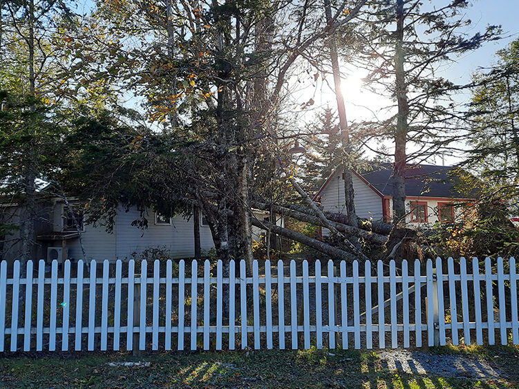
In 2022, Hurricane Fiona, with high winds from an unusual direction, made landfall close to Memory Lane Heritage Village and about 50% of the trees on the site were blown down, or were so compromised they had to be removed. From this loss grew the idea that rather than simply replanting, this was an opportunity to create an Atlantic Coast Arboretum (“a place where trees, shrubs, and herbaceous plants are cultivated for scientific and educational purposes”) on the Memory Lane site.
This natural history storymap of the Atlantic Coast Arboretum Catchment Area will be used with a forest-focused cultural history story map of the same area to guide the planning, building, interpretation and long-term maintenance of the Atlantic Coast Arboretum.
Research & Content by Daniel Yabar with support from Gordon Hammond and the Eastern Shore Archives (Lake Charlotte Area Heritage Society).
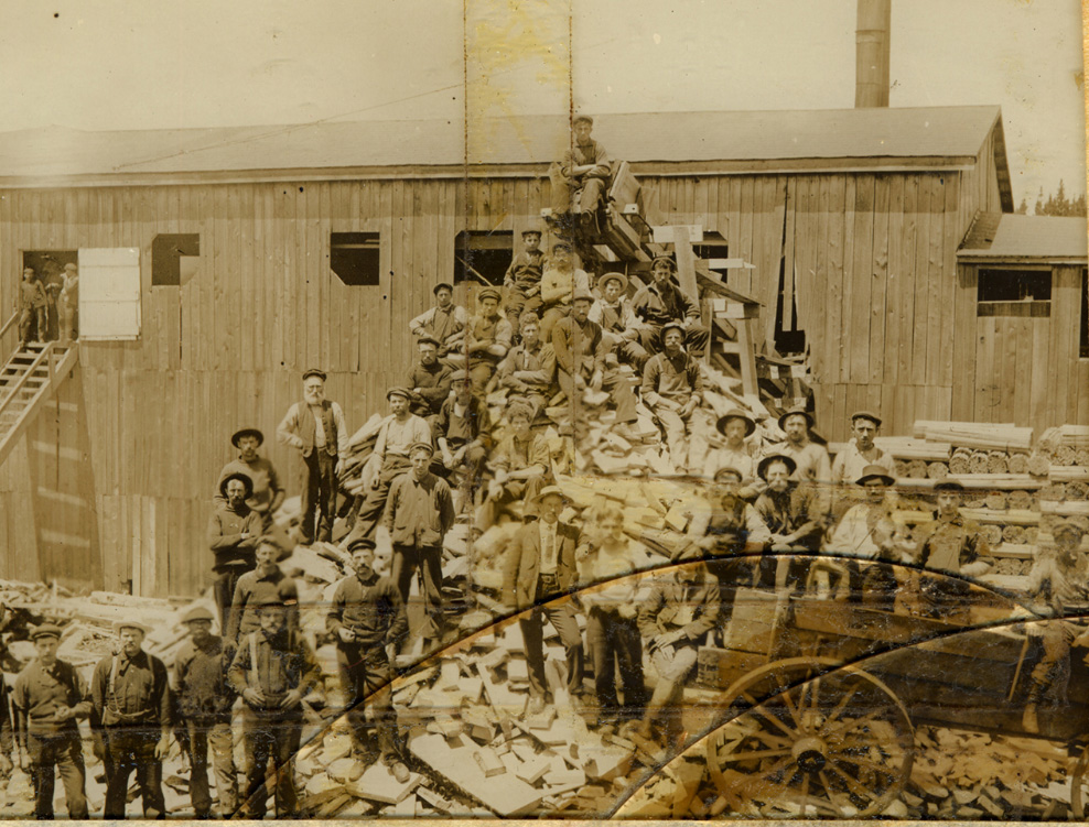
Forestry History – Atlantic Coast Arboretum Catchment Area
Along Nova Scotia’s Eastern Shore, unique coastal forests have shaped the labour and leisure of Mi’kmaw communities, early settlers, and modern settlements. This project explores and maps a history of forests and forestry that connects the communities along the Eastern Shore to their hinterlands up-river. It focuses on the period 1750 to 1950, before the advent of large-scale industrial forestry.
Completed with the support of Dr. Sara Spike, Thea Wilson-Hammond, Lauren Hawes, Casey Smith, Gordon Hammond, the Eastern Shore Archives and Memory Lane Heritage Village, and more.